Wild trails that are good to go any time of year
It’s tempting to shun natural trails in favour of trail centres in the winter but these routes prove there’s still riding to be had if you know where to look. Beat the elements with these awesome all-weather routes:
Goyt Valley, Peak District
26km (16 miles)
A great all-weather low-lying Peak loop. Please be mindful that the Peak District’s popularity and geology mean it is prone to erosion in areas. For advice on when and where to ride responsibly, visit kofthep.com
From Roman Lakes (Landranger 110/SJ969878), pick up the trail that heads SE down the Goyt Valley. Continue SE on the B6101, loop S around the paper mill, then N to cross the road again W of Lee Mills. At Brook Bottom, head E, NE then NNE to Blake Hall, then E past Aspenshaw Hall to a junction W of Lantern Pike.
Head N then E to Rowarth then jink N to Plainsteads. Head W over Cown Edge and at Ludworth, head S to Mellor. Go S then W through Tarden to finish.
For the GPS download click here.
Claerwen Valley, Mid Wales
12km (8 miles)
A short but sweet weather-buster in the heart of Wales.
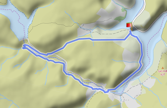
From the NW tip of Caban-coch Reservoir (Landranger 147/SN909638), follow the road down the W side of the lake, turning L at the southern end then R onto a lane then a broad track that leads NW to a bridge (or ford) beneath the Claerwen Dam.
Turn R onto the road and where the two roads meet, take the BW L to join a track. Follow this over the hill and follow the edge of the wood E into the wood. Enjoy a slatey singletrack descent to finish.
For the GPS download click here.
Glen Ample, Scotland
38km (24 miles)
Forest and steep hills keep this loop pretty sheltered, and the surfaces are good most of the way too.
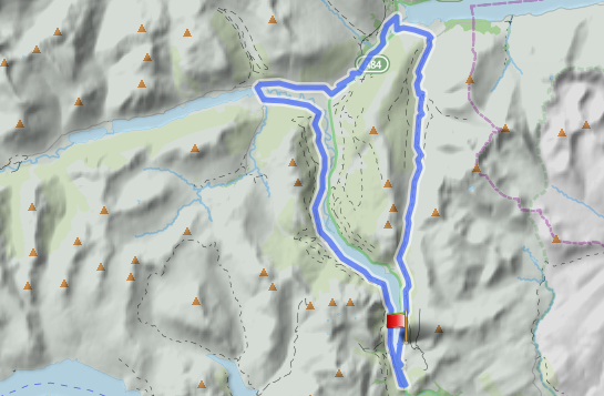
From the E shore of Loch Lubaig (Landranger 51/NN586107), head N on tarmac then forest track to leave the woods on a clear track that leads NW down Glen Ample. Turn L onto the road, then R then L onto Cycleway 7 towards Strathyre.
This loops around Ballquhidder then leads S down the shores of Loch Lubnaig. Cross the bridge at the southern end and follow the road N to finish.
For the GPS download click here
Claife Heights, Lake District
13km (8miles)
Everybody will need to dodge the Lakes weather at some stage in their life; this is a favourite short, sharp blast that ducks the worst of it by not actually gaining much height.
From Red Nab (Landranger 97/SD385994), climb W then turn S onto Basecamp drive. Break L then fork R to a junction, where you go sharp R then sharp L to guide post. Now follow the BW S, forking L to Far Sawrey. Turn L then L again to climb N then NE, then drop to the lake shore, which you follow to the finish.
For the GPS download click here
Sarn Helen, Snowdonia
21km (13miles)
A full-fun winter outing with decent surfaces and a top-notch finish.
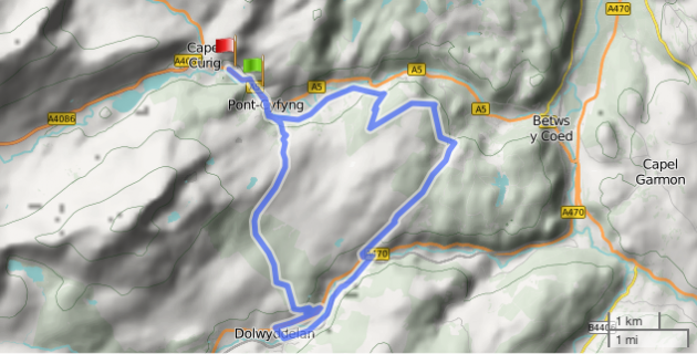
Head SW from Moel Siabod cafe (Landranger 115/SH727557), for 1km then R on a parallel road to a forest track after 2km. Sharp R at the barrier and SA at a X-roads to swing around a RH hairpin. Continue E then S to Sarn Helen and follow this down to the A470.
Turn L then R and R again to follow the track S to Dolwyddelan (tea in the Spar). Take the mapped track N through the forest and across the moors for a tumultuous finish.
For the GPS download click here.
Stockdale Lane, Yorkshire Dales
18km (11miles)
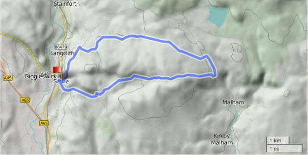
Start at the village of Settle (Landranger 98/SD819638) for this cracking south Dales outing.
From there, head E towards Malham. Break left onto the drive of Stockdale Farm at the top, then keep the farm to the R to clamber up over the pass. Drop to the Malham road and turn L for 1km before taking a track W.
This heads back over the fell, eventually dropping to tarmac. Hang a L then round a R bend before turning L though a gate. Now follow the BW back down into Settle — job done, and cafes and a chippie nearby!
For the GPS download, click here.
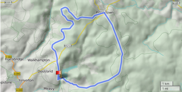
Burrator Reservoir, Dartmoor
25km (16miles)
This one could be started in Princetown, though in winter we prefer visiting there halfway round to make the most of the facilities.
From the reservoir (Landranger 201/SX550680), ride N to the cycle path that comes in from the L. Now follow this to the B3212. Cross and continue on the old railway to Princetown. Take the track beside the Plume of Feathers and follow this S to Nun’s Cross, then W past Eylesbarrow mine ruins to return to the reservoir.
For the GPS download, click here.
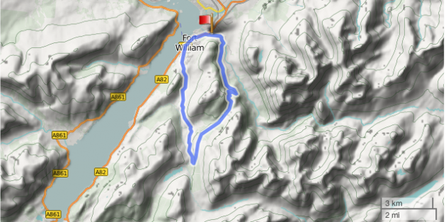
West Highland Way, Fort William
20km (12 miles)
From Fort William, head E into Glen Nevis and continue to the Braveheart car park (Landranger41/NN122736), climb SW to join the West Highland Way.
Now it gets easy — swing SW and enjoy sumptuous singletrack all the way to Kinlochleven. All that’s left is an easy road ride back to Fort William. Note: this route goes against the flow of the WHW… if you are riding at busy times of year, start very early and get off the trail by midday if you don’t want your ride ruined.
For the GPS download, click here.
Best of the rest
Lake District – Lonscale Fell
17km/11 miles / Total Ascent: 600m
A gem of a route that contains a little of everything that’s good about Lake District MTBing without going too high into the mountains. And it’s all on well-drained trails.
The climbs are rough, but do-able and the descents are fast and furious with enough happening to keep concentration levels high. The real highlight is the singletrack; especially the slick rock section that provides the crux. Have you got the skills? Have you got the nerve? It’s a big drop…
Way to go
Start: OS90/NY318256. Lower Car park, Threlkeld
Continue up the lane and past the Blencathra Centre. This becomes dirt and climbs up the side of the valley before plummeting to a bridge. Cross and climb, and at the top you’ll meet the return trail. Follow this up and then down; at Lattrigg Car Park, locate the bridleway that drops to Keswick. Wind your way to the old railway station and hop on the old railway line which provides easy, traffic free cruising back to Threlkeld.
OS Map: OL 4 & 5 The English Lakes North-western & North-eastern areas.
Guidebook: Lake District Mountain Bike Routes by Tom Hutton pb Out There Guides
A map for this route was included in MBR, August 2009
Quantock Hills
17km/11 miles / Total Ascent: 690m
A small range of hills with some big rides — and most of them hold up well in the worst weather. This is a tough 17km by anyone’s standards, but it’s pretty much action all the way with some meaty – yet mainly ride-able – ups, and some scintillating singletrack descents.
The stream crossings mean you won’t stay dry, but you’ll have no chance to get cold, that’s for sure. Our routemeister Tommy H claims the Quantocks as his old stomping ground, and winter weather never kept him out of the hills.
Way to go
Start: OS182/ST154410. Car Park, Holford
Head into the village centre and up the dead end lane past the hotel. Now climb to the road at the top and hang right. A couple of good trails lead to Crowcombe Gate and a climb past Hurley Beacon leads to Halsway Post. Drop sweetly into Stert Combe and continue into Somerton Combe then heave your way out up Lady’s Edge.
Take the spine road north past Beacon Hill and plummet into Smith’s Combe. Climb steeply away and dip into Den’s Combe before clambering over Pardlestone Hill onto New Ground. A steep singletrack drops you into Hodder’s Combe and this leads back to Holford.
Map: OS Explorer Series (1:25 000) 140 The Quantock Hills
Guidebook: South West Mountain Biking by Nick Cotton pb Vertebrate Graphics
A map to this area and some of these trails was included in MBR September 2012
Brecon Beacons – Gap Road
31km/19 miles / Total ascent: 820m
The Gap is legendary among MTBers: this is where your steed sees some real mountains. But despite topping out at 600m, this version of the loop works brilliantly as a winter outing in all but the worst (ie snowy) conditions. It’s all about one trail, really: an ancient throughway that hurdles the main Beacons ridge close to the highest summits.
The climb is long but steady, with amazing scenery to distract. And the top really feels like a high mountain pass — most will want to linger for a few minutes at least. After that it’s downhill all the way, starting out technical enough but rolling into a rugged, rocky belter that just about allows you time to appreciate your surroundings.
Way to go
Start: OS161/SO115225. Talybont-on-Usk
Follow the Taff Trail from the White Hart and head up through the forest for 10km to the road at Torpantau. Swing left and drop to the next section – on your right – and this leads to the foot of the Gap Road.
Climb to the top and blast back down again, and when you reach the road head, take a narrow trail half right. Continue west on lanes to Tynllwyn and finish on the riverside bridleway to Llanfrynach.
Map: OS Explorer Series (1:25 000) OL 12 The Brecon Beacons National Park, Western & Central Areas.
Guidebook: Wales Mountain Biking by Tom Hutton pb Vertebrate Graphics
A map for this route was included in MBR August 2010
Peak District – Stanage Edge
26km/17 miles / Total Ascent: 700m
Stanage Edge is synonymous with rock climbing but it’s pretty damned good on an MTB too – especially in the winter months when the grippy, gritstone trails really come into their own and the area as a whole is a lot quieter.
This odd-shaped figure-of-eight makes the best of all the trails in the area with cruisy moorland stuff on Houndkirk, steep and rooty (and sometimes gloopy) through the plantation, and a rocky horror show descent of the Causeway to finish.
Way to go
Start: OS110/237837 Stanage Plantation
Turn left out of the car park and take the tarmac steeply up past Burbage towards Ringinglow. As you start to drop from the top, take the trail on the right and follow it over the crossroads and down to the A626. Take the bridleway left to drop steeply through the plantation and then sharp right to loop back up via Blacka Hill.
Get on the A6187 and take the trail right to cross the crossroads again and drop into Ringinglow. Use tarmac to loop around the reservoirs and climb up onto Stanage. Stick with the main track to descend.
OS Map: OS Outdoor Leisure Series (1:25 000) 1 The Peak District; Dark Peak Area.
Guidebook: Dark Peak Mountain Biking by Jon Barton pb Vertebrate Graphics.
A map for a similar route to this one was included in MBR December 2010
Chiltern Hills – South of Wendover
22km/14 miles / Total Ascent: 540m
It may be less rocky down in the suburbs of the south east, but there are still some areas that will ‘go’ all year round and some seriously good fun trails too.
The hills south of Wendover prove this to perfection: plenty of short, sharp ups, a good few steep and steppy downs, and mile after mile of high grin factor woodland singletrack that can be as hard and fast as you make it. A frosty day will make it even better; and as it kicks off from a station, you don’t even need to defrost the windscreen…
Way to go
Start: OS165/SP865077 Wendover Station
The Icknield Way Path leads uphill south from Wendover and links with some top-notch singletrack that carries you to Little Hampden. Road leads to Hampden House and the estate road plunges you back into the woods.
More Icknield Way Path leads to Pulpit Hill, where a must-do loop drops all the way down to the road before climbing back up the other side of the ridge. Now head for Buckmore End and follow more wooded bridleways as well as road to the car park at Low Scrubs where a great descent awaits.
OS Map: OS Explorer Series (1:25 000) 181 Chiltern Hills North
Guidebook: Rough Ride Guide to the Chilterns by Max Darkins pb roughridesguide.co.uk
A map for this route was included in MBR September 2012
Around Hayfield – Peak District
25km/16 miles / Total Ascent: 1050m
Hayfield may be on the edge of the Peak District National Park but it’s smack bang in the middle of some great MTBing. It’s also home to XC and cyclo-cross legend Nick Craig, and if it’s good enough for him then it’s certainly good enough for us.
Nick’s training route is an ideal winter run-out, firstly because it takes in some stonking trails, all of which work all-year round; and secondly because it forms a clover leaf with Hayfield as the hub, which means it’s ideal if you get too cold, wet, muddy, benighted or even just tired. Ride as many or as few of the loops as you fancy and then head back into town for a cuppa, a pint or some slap-up grub. Please be mindful that the Peak District’s popularity and geology mean it is prone to erosion in areas. For advice on when and where to ride responsibly, visit kofthep.com
Way to go
Start: OS110/SK035869 Hayfield Information Centre Car Park
The Sett Valley Trail runs to Birch Dale and from there it’s a monster pull up Over Hill Rd onto Chinley Churn. Sandy trails lead over Ollersett and back down to Hayfield. Highgate Road leads back uphill and a good trail climbs to the top of Elle Bank Woods. Sharp left and all the way down again.
Another U-turn at the bottom then a clamber up into Coldwell Clough, where you continue east to pick up the bridleway to Kinder Reservoir (this section needs a bit of respect in really wet weather). Climb onto Middle Moor and if you’re as tough as Nick, continue down to Carr Meadow before turning tail and climbing back up to the shooting hut.
Now turn right and drop back into Hayfield, although things can be extended further with an extra loop around Lantern Pike.
OS Map: OS Explorer Series (1:25 000) OL1 The Peak District, Dark Peak Area
Guidebook: Peak District Mountain Biking by Jon Barton pb Vertebrate Graphics
A map to a similar route to this one was included in MBR May 2010. Download the GPS route here.
Ciaran Path – Kinlochleven
22km/14 miles / Total Ascent: 770m
Ask Andy McKenna of Go-where.co.uk where he’d head in the worst of conditions and the answer may surprise you: Kinlochleven in the heart of the Highlands. Why? Mainly because the riding’s just so good – the Ciaran Path won the MBR Trail of the Year in 2009 and boasts some mind-blowing scenery, especially in winter when the surrounding peaks are covered in snow.
But it’s not just that –the predominantly rocky surfaces ‘go’ in pretty much all conditions. There are many trails radiating out from the town so you can also make your ride as short or as long as conditions allow.
Way to go
Start: OS41/NN188619 Ice Factor, Kinlochleven
Climb on good tracks north to the Mamore Lodge Hotel and keep heading east towards Loch Eilde Mòr. A right turn halfway down the descent drops you to a small dam west of the loch and from there just follow the pipeline, eventually dropping to meet the Ciaran Path above Dubh Lochan. Now drop your saddle and enjoy one of the best descents in the land all the way back to the Ice Factor.
OS Map: OS Explorer Series (1:25 000) 384 Glencoe & Glen Etive
Guidebook: Scotland Mountain Biking by Phil Kane pb Vertebrate Graphics. Download the GPS route here.
Thetford Forest – Norfolk
Various routes / Total Ascent: Not much…
When the weather really won’t play ball in the uplands, it makes sense to turn to the least mountainous part of the UK. Especially as it’s chokka with so much great MTBing. No mountains, no problem: these woods really are full of sinuous, sweeping singletrack.
And there’s only one way to tackle it: full pelt, and that means pedalling, hard. That’ll keep you warm. Added to which, you’re never gonna get the full blast of an icy easterly through all those trees. But if you do need to warm up afterwards, the coffee and cake at both High Lodge and Brandon Country Park is pretty good too.
Way to go
The red route (Beater Trail) gets the full grin factor and flows so sweetly – well done to TIMBER for doing such a great job on it. The Lime Burner (Black) will test skills and balance a little bit more and comes highly recommended.
The endura trails over the Brandon side need a pioneering approach but are great for getting away from the crowds. Or, if you’d appreciate some guiding, Get Mountain Biking (www.getmountainbiking.co.uk) know this neck of the woods better than anybody.
Swaledale – Yorkshire Dales
37km/23 miles / Total Ascent: 1440m
The Dales Bike Centre at Fremington is perfectly positioned for a winter tour of the Dales, and this one comes personally recommended by Stu Price, the centre’s head honcho.
It’s basically a pretty hefty tour of Swaledale; heading out from the centre on firm but fun tracks that run along the felltops on the southern side of the dale; and then dropping back to the Swale before a big climb up onto the northern fells. The return leg’s a belter: a real mix of trails including some rough but scenic singletrack and a full-on, full-pelt descent into Low Row.
Way to go
Start: OS41/SE046988 Dales Bike Centre
Climb past Swale Hall then take a steep bridleway climb onto Harkerside Moor (trail starts at SE031982). Now follow the hilltops west almost to Apedale Head and plummet to Low Row. Head up the dale on the track that runs south of the river to Gunnerside and join the main road.
Cross the bridge and hang left to Dyke Head, where you take the bridleway north to Gunnerside Gill. Cross and turn tail to drop to Low Row Pasture and down to Low Row itself. Return to Grinton on the south side of the river. Pop into the centre for other ideas.
OS Map: OS Outdoor Leisure (1:25 000) 30 Yorkshire Dales; Northern & Central Areas
Guidebook: Yorkshire Dales Mountain Biking: the North Dales by Nick Cotton pb Vertebrate Graphics
A map for a similar route to this one was included in MBR November 2012

